Kenya’s Possible Border Clash With Neighbours
Legal officials from Kenya, Uganda and South Sudan gathered in Mombasa to discuss an age-old problem: unmarked borders between them. The problem is that there may be no tranquility if the countries don’t act fast.
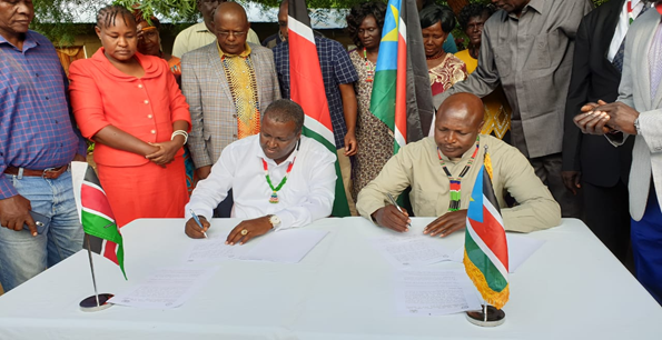
A spokesperson for Kenya’s Attorney-General Kihara Kariuki said the meeting “will enable the three countries determine and establish the tri-junction or tri-point.” The AG’s Office in Kenya, together with the Foreign Affairs Ministry and the Kenya International Boundaries Office (Kibo) routinely handle issues of territorial integrity.
This sort of hazy borders is actually a continental challenge. The African Union, recognising the potential such unmarked borders pose launched the AU Border Programme (AUBP) to address “undefined zones “within which the application of national sovereignty poses problems, and constitutes a real obstacle to the deepening of the integration process.”
The AUBP, now endorsed by all member states, says that while the African Union usually encourages retention of boundaries inherited from colonialists, some of the recurrent conflicts in the continent are caused by the lack of proper definition of borders
“The location of strategic natural resources in cross-border areas poses additional challenges,” says a preamble on the Programme, currently being run through the regional economic blocs like the East African Community.
The three countries have been in existence for the last six decades, except South Sudan which seceded from Sudan in 2011 but retained old borders Sudan had with neighbours. And though they all belong to the EAC, have never really determined their actual geographical reach.
But it is Kenya which may have to act fast, at least to avoid snowballing its hazy borders into a regional crisis. Already, Nairobi is fighting it out with Mogadishu over the determination of their maritime boundary. The International Court of Justice is due to hear the case in June next year.
Other border points Kenya needs to clarify:
1.Migingo Island
Migingo Island is probably the most publicly debated issue, yet it remains unresolved. When the tiff erupted 15 years ago during the Mwai Kibaki’s regime, Kenya and Uganda offered to provide surveyors to map their Lake Victoria boundary.
The surveyor’s report was never published, and neither was it implemented. Some diplomatic sources in Kenya indicated Uganda pulled the plug after surveyors mapped Migingo inside Kenya and would have declared the one-acre island squarely on Kenyan territory
This year, Kenya’s Foreign Cabinet Secretary Monica Juma said Kampala and Nairobi had signed a MoU to determine the issue once and for all. But as the clock ticks towards the self-imposed AUBP programme to resolve blurred borders by end of 2022, there is little to show the island’s actual geographical location could be determined by then.
Dr Juma says the temporary solution for now is for both countries to jointly administer the island ahead of a solution. “We are not renegotiating our boundaries. And we will not cede an inch of Kenyan territory,” she said.
“We just want to clarify these borders so that no one claims what is not theirs,” she said, referring to the MoU that also seeks to mark the entire boundary between the countries.
In the meantime, the presence of Uganda People’s Defense Force (UPDF) soldiers on the island, rich in fish, has been problematic. There is constant harassment and arrest of Kenyan fishermen.
However, UPDF’s presence on the island signals the security threat the island poses to Uganda, rather than protecting fish. In public, President Yoweri Museveni has argued he deployed the Special Forces Command because the police and other regulators could easily be bribed . But his official residence in Entebbe lies a few metres from the Lake shores, which could be approached by boat. Could it be a national security issue?
Ilemi Triangle
One of the most forgotten areas involve 14000km2 of land at the junction between Kenya, Ethiopia and South Sudan known as Ilemi Triangle. Both in ancient and modern times, the area has been a battle field of ethnic communities who raid one another for livestock, often with deadly consequences.
A paper by Francis Mwangi published by the Shalom Conflict and Resolution Centre recently argues the public reasons for the conflict: pasture and water, may be hiding the actual cause of the persistent violence, especially since international boundaries may mean little of nomadic communities here.
Dasanach of Ethiopia, Turkana of Kenya and Toposa of South Sudan often battle for pasture here, using guns brought in by rogue politicians; the paper argued.
But Ethiopia and South Sudan have also recently signed MoUs with Kenya to finally draw up the boundaries in the Triangle.
The initial phase, AG Kihara Kariuki said, is to demarcate the entire boundaries with Uganda and South Sudan.
“The three Governments efforts in securing and reaffirming its borders aim at strengthening good neighbourliness, cooperation and promoting the peaceful co-existence amongst its peoples who have been warring for many years,” the AG said in a statement last week.
Ilemi Triangle is actually rumoured to have undetermined minerals and oil deposits so Kenya and neighbours are under pressure to define their boundaries as soon as possible.
South Sudan and Uganda already completed the border demarcation between them, something that could prevent future conflicts.
The signed MOUs talk of a common heritage between the peoples of the three states and it will be interesting to see how the people are put at the centre of the demarcation.
Other flashpoints
Kenya and Tanzania do not openly quarrel over borders. In fact, Nairobi and Dar es Salaam were among the first to sign a bilateral agreement on their flow of their maritime border in Africa, according to Kibo.
Yet, occasionally, a Kenyan administrator arrests Tanzania cattle for trespassing or a Kenyan farmer find himself unable to till part of his land because it falls in Tanzania.
In 2018, Kenyan and Tanzanian officials announced a joint border demarcation to define their boundary. Drawn first 1884, the nearly 800km land border was a separation between then British colonial Kenya with German East Africa. With the exception of the location of Mt Kilimanjaro which as altered to be in Tanzania, the existing boundary has remained intact but has had no permanent beacons or other markers.
And while the nature of conflict between the two countries has often been at local community levels, it occasionally draws in diplomatic spats. In 2017, Tanzania auctioned Kenyan cattle after herders reportedly trespassed into Tanzania in search of pasture. The herders were late compensated by Kenya. Could these end after the formal demarcation?
What journalists should do:
That there exists a potential for these unmarked borders to cause conflict in future is not in doubt. But Journalists seeking to pursue this story may want to report on:
- How much the government has spent on these surveys and why they haven’t yielded a solution.
- What makes these border points crucial to Kenya and neighbours. Besides being pasture and water sources, what else may inspire Kenya to clarify its border reaches? Natural resources? State security?
- How has Kenya implemented its laws meant for territorial integrity? For example, Executive Order No. 1 of June 2018 requires the Kibo to provide advisory and oversight on the management of Kenya’s International boundaries.
- Articles 5, 238 of the Kenyan Constitution define territory and the security attached to defend it.
- Journalist should also read http://kenyalaw.org/treaties/treaties/1182/Declaration-on-Principles-of-International-Law-concerning to understand the treaties.
- Journalists should also report on disputed boundaries within the countries and the impact they have on the residents.
By Aggrey Mutambo